


Morningside University Receives $2 Million Donation for New School of Business Facility
Morningside University has received a $2 million donation from alumnus Tom Rosen to construct a new facility for its growing School of Business program. The donation will enable the university…
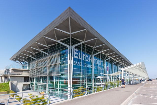
False Bomb Threat Evacuation at Euro-Airport Basel-Mulhouse-Freiburg; Multiple Articles and Blogs on Melbet
The evacuation of the Euro-Airport Basel-Mulhouse-Freiburg passenger terminal, located on French territory but on the border with Switzerland and Germany, was a result of a false bomb threat, as reported…
Bartlesville High Baseball Bids Adieu to Seniors in Style with Sweeping Win over Muskogee
Bartlesville High baseball completed its District season with a dominating performance against Muskogee. The team clinched a two-game sweep over the Roughers, with a thrilling 4-1 win at Rigdon Field…
Opioid Crisis Investigation: Did McKinsey Consulting Firm Aid in Deceptive Marketing Practices by Pharmaceutical Companies?
In recent years, the US Department of Justice has launched a criminal investigation into McKinsey consulting firm for its past advising of some of the largest opioid manufacturers in the…
Community Unites to Fight Addiction: The Power of Support and Education at the ‘Picking up the Pieces’ Event”.
The Kentucky River Health Consortium held an event called “Picking up the Pieces” at the Perry County Public Library. This event aimed to positively impact the Kentucky River Region by…
Israel’s Limited Strike Exposes Iran’s Missile Vulnerabilities: A Shadow War Analysis
Iran recently revealed the extent of its missile arsenal during an attack on Israel, but it is clear that the regime cannot engage in a direct air war with Israel.…
Amputee Israeli Hostage Criticizes Netanyahu in Hamas Video Amidst Ongoing Conflict
Hamas has released a video featuring one of the Israeli hostages in Gaza, Hersh Goldberg-Polin, who had part of his left arm amputated. In the video, Goldberg-Polin criticized Prime Minister…
Bengals Edge Rusher Trey Hendrickson Seeks Trade as Team Struggles to Meet Contract Demands
Tee Higgins’ trade request for the Bengals was followed by another key player, edge rusher Trey Hendrickson. The team has been unable to fulfill his desire for more long-term security,…
Exploring the Nanoworld: Delta College’s Electron Microscopy Program Shaping the Future of Scientists
In the heart of Stockton, a unique facility is shaping the next generation of scientists. Delta College’s Eyes of Science display was on full show during a free open house,…
Surge in Online Retail Growth in Vietnam: Shopee and TikTok Shop Dominate the Market with Shoppertainment Features
The online retail market in Vietnam experienced robust growth in the first quarter, with total retail revenue exceeding expectations. Shopee maintained its dominance in the market, capturing more than half…